
Hiking Los Pinos Peak in Cleveland National Forest
We had been on a bit of a travel freeze for the past couple of months, staying close to home while our cat, Zoe, recovered from a broken ankle. She needed a lot of extra care and attention, and after eight weeks in a splint she was finally able to have it removed. It felt like the perfect excuse to get back out on the trail, so we headed for Cleveland National Forest.
Of course, Southern California decided to throw an October heat wave our way. Rather than driving hours into the desert, we looked for somewhere a little higher in elevation and settled on Los Pinos Peak.
The drive to the trailhead follows Ortega Highway past the Candy Store before climbing into the hills of Cleveland National Forest. The hike begins on the Main Divide Truck Trail, a steep fire road that's open to high-clearance four-wheel-drive vehicles. As we were getting ready to start hiking, we watched a truck and a Jeep air down their tires before heading up the road. Note: Check whether driving the fire road is permitted, as closures occasionally happen.
After hiking the first 1.7 miles ourselves, we were pretty sure our Subaru Crosstrek could have made it too, saving us both some distance and a fair amount of climbing.
Normally we pack everything the night before and get an early start, but this time we didn't. We reached the trailhead around 11:00 a.m., right as the day was heating up. That turned out to be less than ideal, since this trail offers very little shade. The bugs were out in full force too, and they followed us for nearly the entire hike. Thankfully we'd tossed our face coverings into our packs at the last minute. They kept the bugs away from our faces while also protecting our necks from the sun.
At the top of the fire road you'll come to a metal barricade. Some hikers climb directly over it and head straight up the hillside, but the actual Los Pinos Trail begins just to the right. Both routes join together a short distance later, and from there the trail is easy to follow all the way to the summit.
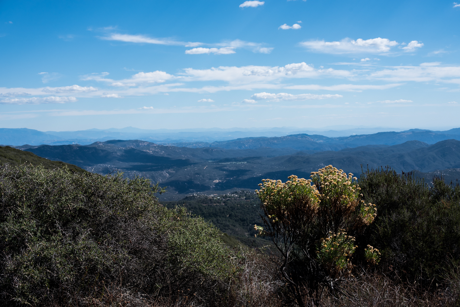
The views get better with every bit of elevation you gain. About a mile beyond the end of the fire road, you reach the summit of Los Pinos Peak at 4,513 feet, making it the fourth-highest peak in Orange County. On a clear day, the surrounding mountains seem to stretch on forever, and after the long climb it feels like a well-earned reward.
The trail itself is quiet and doesn't see nearly as much traffic as many other Orange County hikes. Some sections are smooth, while others are steep and covered with loose gravel, so sturdy hiking boots make a big difference. I'd also recommend bringing bug spray, sunscreen, plenty of water, and trekking poles if you like having a little extra stability on the climb back down.
We hiked about 2.7 miles to the summit before turning around and retracing our steps, making the day just over 5.5 miles round trip. The October heat was unusually intense, the bugs tested our patience, but the trail was easy to follow and the views made the climb worthwhile. After spending the previous couple of months close to home, it simply felt good to be back out exploring again.


