Fall Weather at Deer Springs Trail
We had an abnormally warm October in Southern California. It was hot, and oddly humid. So when we were picking a hike to do a few weekends ago, the number one requirement was to drive up into the mountains somewhere to feel some serious fall weather. Idyllwild is kind of a go to spot for us, its close, and has a special coziness for me since I lived up there for a few years when I was a kid.
We decided on this trip to hike up Deer Springs Trail to Suicide Rock. We have been slowly gearing ourselves up for an overnight backpacking trip, and one of our bucket list trips is hiking up to the peak of San Jacinto. Deer Springs Trail takes you up a few miles to a fork where you can continue either split off to Suicide Rock or continue up another 7 miles to the peak of San Jacinto.
The weather was perfect for hiking. Clouds kept rolling in and out to provide shade and cool 50 degree temperatures, but would also break and let the sun out to warm us up and provide some different lighting. While I expected the trail to be more busy, it being a Sunday and a little chilly we passed a few groups of people and a few other couples and that was about it!
This is a good moderate trail that starts at about 5,600 feet and gains over 1,200 feet in the first 2.5 miles. We took a quick break once to sit on a big rock and scramble around, while also enjoying a cliff bar. At the 2.3 mile point the trail splits and you can either go to the right and head out to Suicide Rock or to the left which will take you all the way to the peak of San Jacinto if you want to hike another 7 miles! This is on our backpacking list because you can stop and camp at Little Round Valley before heading all the way up to the peak.
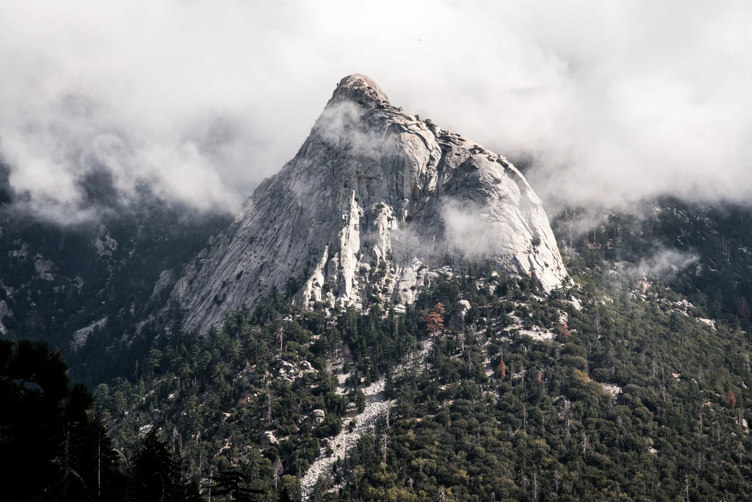
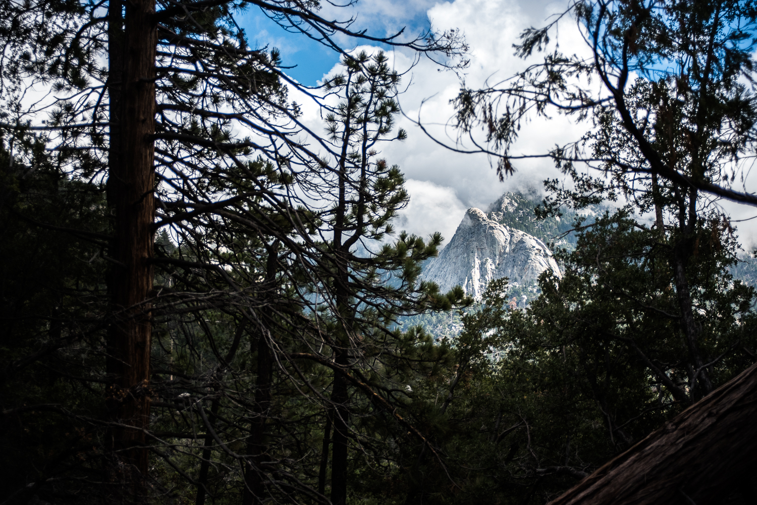
We took the trail to the right and headed out to Suicide Rock, a little over a mile with very little elevation gain. There is a creek that we crossed that actually had a little bit of water in it - always a good thing to see hiking in Southern California! Probably the best part about this hike is the views across the valley of Tahquitz Peak. We stopped a lot to catch glimpses of it as the clouds moved in and out of the valley.
Once at the "peak" of Suicide Rock you'll come to a field of pine needles, if you look up and to your right you'll see whats considered the peak and nestled in some rocks is a generic can (which used to be a Smiley face can) that has a peak register - we added a couple first aid goodies - signed it and headed out to the edge of the rock to have another quick snack before returning to the trail and heading back down.
The descent back to the car was much quicker than the climb up, of course. We stopped a few times to scramble out on the rocks and catch some different views of the valley and Tahquitz Peak. In total, the hike took us about 5 hours at a very moderate pace and a lot of pauses and back tracks and wanderings to capture the sights.
The town of Idyllwild is the epitome of a quaint mountain town with down to earth people and some awesome PCT thru-hikers that take a step out of the wild for a moment before continuing on their trails. We definitely recommend The Lumber Mill for some good post hike food - burgers, fries and a cold beer for me! - before heading back home.
Tips:
This trail is about 4 miles each way including going up to the peak at the top to fill out the registry.
While I would rate this as a moderate hike, I definitely recommend trekking poles if you have them. Your legs deserve the extra help on any trail with over 2,000 foot elevation gain in my opinion!
A Day Permit is required for this hike and can be easily obtained at the Idyllwild Ranger Station.
Wear layers! I removed and added my Eddie Bauer Lookout shirt multiple times depending on how much we were climbing and whether the sun was out or hidden behind the clouds.