Deer Springs Trail to Suicide Rock: A Fall Hike in Idyllwild
Southern California had been holding onto summer much longer than we wanted. October was unusually hot and humid, so when we started looking for a weekend hike, our main requirement was simple: we wanted mountains, cool air, and something that actually felt like fall.
Idyllwild was an easy choice. It is close enough for a day trip, but the higher elevation makes it feel far removed from the warm streets below. We also have a soft spot for the town because Kim lived there for a few years as a kid. The pine trees, weathered cabins, and cool shadows have always felt familiar to her.
Fall Weather on Deer Springs Trail to Suicide Rock
We chose Deer Springs Trail, following it to the junction with Suicide Rock Trail and then continuing to Suicide Rock. Deer Springs Trail is one of the routes that continues deeper into the San Jacinto Mountains, so this hike gave us a small taste of the longer climb to San Jacinto Peak.
Hiking Through the Clouds
The weather was exactly what we had hoped to find. Clouds moved through the mountains all afternoon, lowering the temperature into the 50s and keeping most of the trail in cool shade. Every so often, the cloud cover opened and sunlight spilled across the rocks and pine trunks, completely changing the light around us.
Despite hiking on a Sunday, the trail was quieter than I expected. We passed a few small groups and couples, but we often had long stretches of forest to ourselves.
Deer Springs Trail begins near Highway 243 at about 5,600 feet. The climbing starts early and stays fairly steady as the trail rises through oaks, pines, boulders, and patches of manzanita. In damp places, fallen pine needles softened the trail, and moss spread over the shaded sides of the rocks.
We were not in a hurry. We stopped to photograph ferns, climb onto a few safe boulders beside the trail, and enjoy a snack in a shady spot. Massive pinecones rested among the needles beneath equally massive trees.
The trail reaches a signed junction after about 2.3 miles. Deer Springs Trail continues toward the higher country around San Jacinto Peak, while the trail to Suicide Rock turns right for approximately one more mile.
Views of Tahquitz Peak
The section beyond the junction was easier on our legs, with less climbing than the first part of the hike. The trail continued through the trees, occasionally passing close to steep slopes and rocky drop-offs.
At one point, the path passed through the opening beneath a fallen tree. Farther along, we crossed a small creek that held a little water from recent rain. Seeing moving water on a Southern California trail always feels special, though hikers should not depend on finding water here.
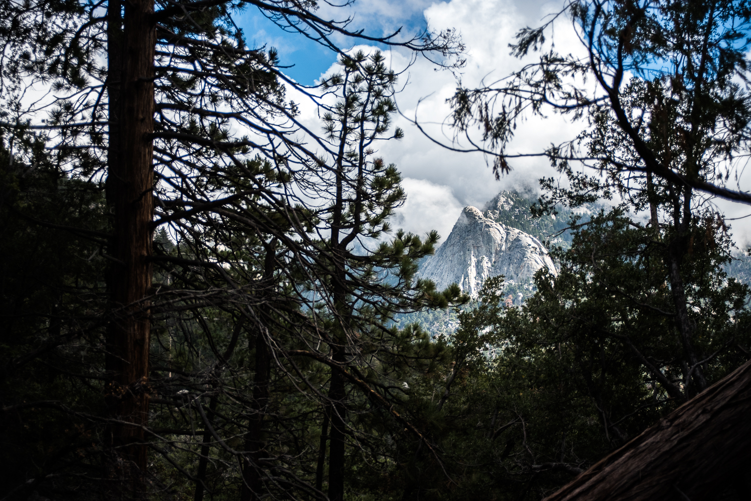
The best part of this section was watching Tahquitz Peak appear and disappear across the valley. One moment the granite face stood sharply against the sky, and the next it faded behind a bank of pale clouds. We stopped often, partly to rest and partly because the light kept changing.
From some openings in the forest, Tahquitz looked close enough to study in detail. From others, we could see only a gray outline between the trees.
Reaching Suicide Rock
Near the top, the forest opened into a broad area carpeted with pine needles. The summit area is not marked by a dramatic mountain point. Suicide Rock is a wide granite formation with several places to wander, rest, and look across Strawberry Valley.
We found the summit register tucked among the rocks, signed our names, and carefully returned the container to its hiding place. Then we moved out to a comfortable spot on the granite for another snack.
Clouds were still drifting through the valley below us. Tahquitz Peak rose across the way, appearing briefly in full sunlight before the gray mist moved through again. The shifting weather made the view feel different every few minutes.
Suicide Rock is also a well-known climbing area, with steep routes along its face. The broad upper area where hikers arrive feels relatively gentle, but there are exposed edges nearby, so we kept our distance and stayed on solid ground.
The Hike Back to Idyllwild
The descent went much faster than the climb, although we still stopped for photographs and views through the trees. Recent rain had left the forest smelling damp and earthy, with moss brightening the darker boulders beside the trail.
Our hike took about five hours, including plenty of pauses, wandering, snacks, and photography. A faster hiker could complete it in less time, but this was one of those trails where we enjoyed moving slowly. The shifting clouds and occasional sunlight gave us a reason to enjoy the hike.
Afterward, we headed into Idyllwild for burgers, fries, and cold drinks at The Lumber Mill Bar & Grill. Idyllwild has the comfortable feel of a small mountain town, with hikers coming off the trails and people lingering along the main road beneath the pines. It was a good place to warm up before driving back down toward Southern California’s lingering heat.
Deer Springs Trail to Suicide Rock Details
The hike to Suicide Rock is approximately 6.6 miles round trip, beginning at the Deer Springs Trailhead on Highway 243. It climbs from roughly 5,600 feet to 7,528 feet, for an elevation gain of about 1,900 feet.
I would consider it a moderately strenuous hike because of the steady climbing and elevation. Trekking poles can help on both the ascent and the rocky descent, especially if your knees tend to feel long downhill sections.
A wilderness day-use permit is required. Permits may be completed online or obtained from the self-service permit station outside the San Jacinto Ranger District office in Idyllwild. Check current Forest Service alerts, weather, fire conditions, and trail reports before leaving home, especially during winter or following storms.
Carry all the water you will need. A seasonal creek may contain water after rain or snowmelt, but there is no reliable water source along the hike.
Dogs are not allowed on this route because it enters Mount San Jacinto State Park Wilderness.
Layers are useful throughout the year. We repeatedly added and removed shirts as the sun disappeared behind the clouds and returned again. Conditions at more than 7,000 feet can feel completely different from the weather down in the valley.
Always check for closures, fire restrictions, and weather impacts before heading to the trail!